Brabo III in pictures via handy digital app
In English: A short summary for the project can be entered here. Don't make it too long because this summary will also be used in the news item widget.
Landmarks for local residents
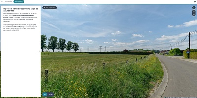
The three sub-projects can be found in the interactive map app in both the current and future situations. The entire area can be navigated using labels positioned on strategic landmarks. Using the interactive map app local residents can easily orient themselves within the area. Zooming in on landmarks opens panoramic visualisations, in which the current situation can be compared with the future situation by means of a 360° image. The visualisations shown are intended to give an impression of the future situation; they are not binding or definitive.
View of upgraded overhead line much the same
With this interactive map app, Elia aims to clearly visualise the impact of the works. This is mainly important for upgrading the high-voltage Liefkenshoek-Mercator line. Since this involves upgrading an existing overhead line, a link is quickly made with heavier and larger high-voltage pylons. However, in the Brabo III project, Elia is using insulated pylon crossarms in order to minimise the visual impact. Certain pylons will be strengthened. This will happen at locations where the overhead line forms a corner, changes direction sharply or is in the vicinity of railways, waterways or road infrastructure.
Curious about the future situation in your area? Consult the Brabo III Project Atlas here